Water Quality Buoy
LSPA’s buoy is part of a world-wide lake buoy network called Global Lake Ecological Observatory Network (GLEON). The buoy collects and transmits air and water data (weather and in-lake conditions) every ten minutes, round-the-clock, 365 days of the year.
If the page has not updated and you are on a computer, you can refresh the live buoy data using command-shift-R (Mac) or control-shift-R (Windows). If you are on a mobile device, you still need to open an incognito or private browsing window. Thank you!
To view weather conditions from local LSPA monitoring stations around the lake, click here.
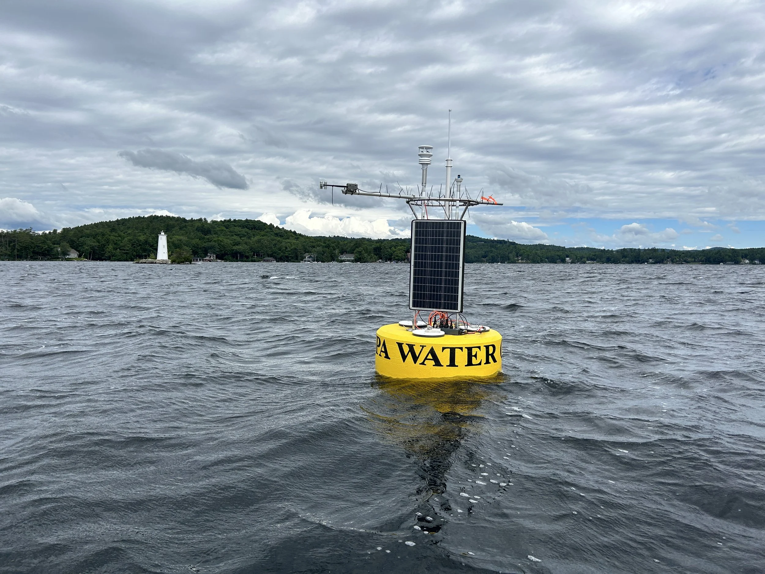
LSPA deployed a brand-new buoy structure (pictured on the right) and new sensor equipment in early May 2024. The buoy is located in Lake Sunapee at 43° 23' 28.37" N / 72° 3' 28.38" W near Loon Island Lighthouse from May through early November annually. During the winter months, the buoy is tethered in Sunapee Harbor and continues to collect and transmit some data.
Instruments on LSPA’s water quality buoy record air and water data (weather and in-lake conditions), which are sent to LSPA's Center for Lake Studies via radio transmitter every ten minutes, round-the-clock, 365 days of the year.
The recorded data from the buoy is also sent to the Global Lake Ecological Observatory Network (GLEON), an organization that works to understand, predict, and communicate the role and response of lakes in a changing global environment.
The instrumentation on the buoy records:
air temperature
wind speed & direction
humidity
sunlight energy (PAR/radiometry)
water temperature at the surface and at every meter down to ten meters
dissolved oxygen in the water (at the surface and at 10 meters)
electrical conductivity of the water
chlorophyll-a (used as a measure of the concentration of algae in the water)
phycocyanin (used to measure the presence & abundance of cyanobacteria)
dissolved organic matter in the water
underwater lake sounds (hydrophone)